Aerial Analytics
Operational Excellence using Aerial Images and Sensor Data

Operational Excellence using Aerial Images and Sensor Data
Our combination of drones, sophisicated sensor hardware and data analytics give greater insights to farm and land managers
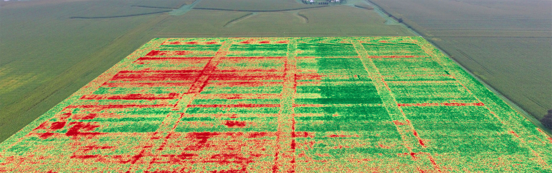
We help you identify issues with your crops such as pests, soil condition, disease and plant health. Taking periodic readings of the same area gives an indication of crop growth over time and can be used to optimise your operations
Using high resolution ariel imagery we can help you with general farm planning, irrigation channel planning & design using cost effective technology to help you increase your yields.
Land and environmental planning
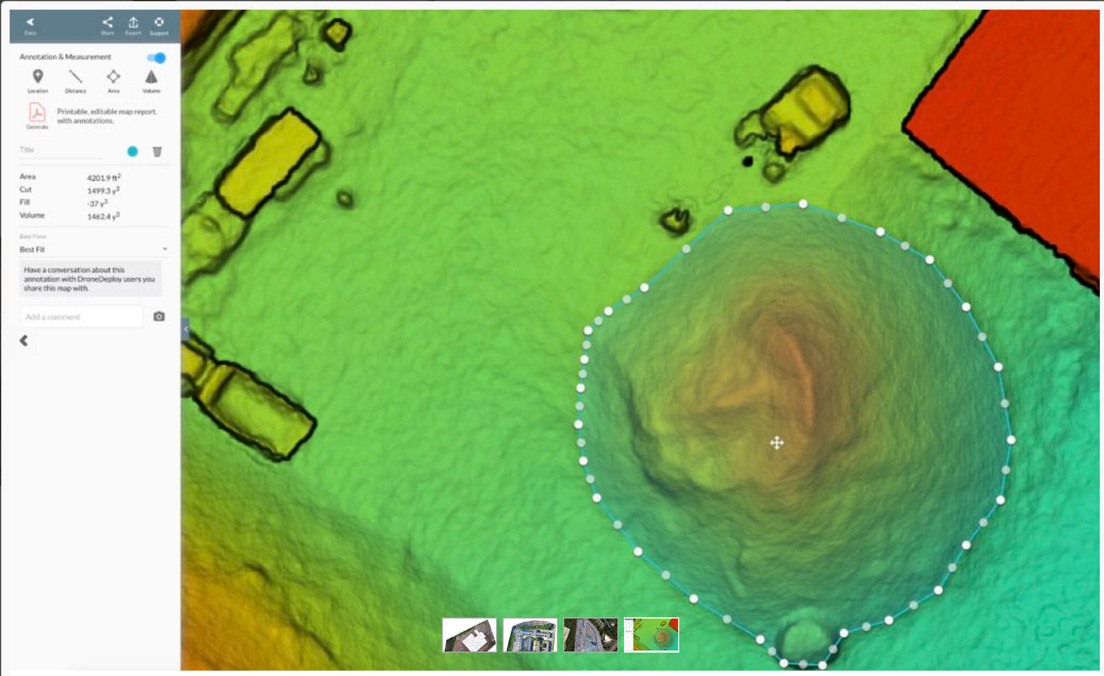
Using images captured from drones we can calculate material volume on site, survey land, create topographical maps quickly and cost efficiently.
Using Drones to manage property inspections and visualise pre and post capital works
A drone can quickly and safely capture still images and videos that can be used to provide quick checks of hard to reach areas for property managers, or for capturing images pre and post capital works for marketing and project management purposes
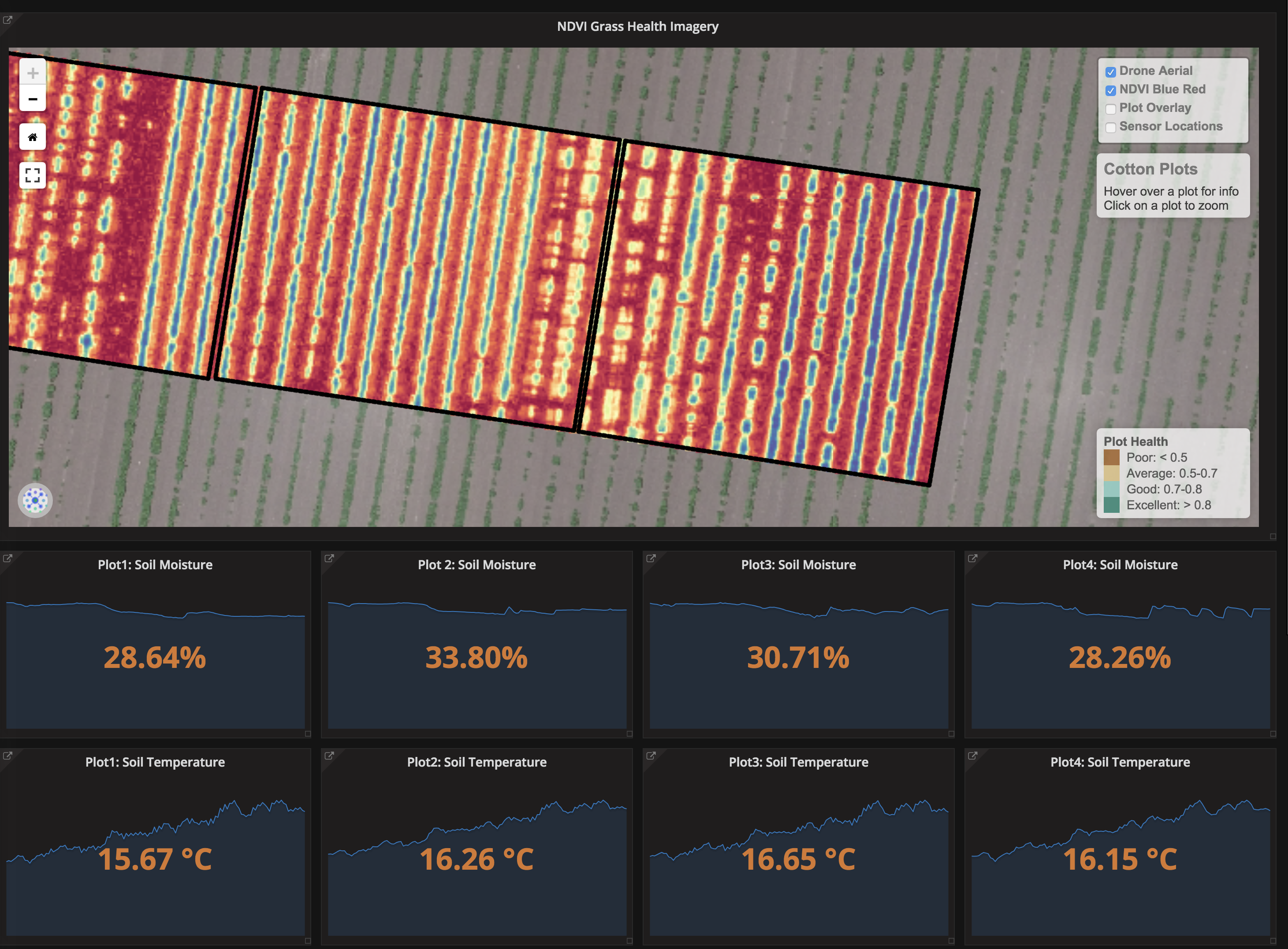
In ground Sensors can be installed to analyse and monitor critical land and agricultural data
Aerial Analytics also sell and install various sensors such as weather stations and soil sensors, and by combining this with aerial imagery we provide an interactive dashboard to give you the real time insights to manage your land
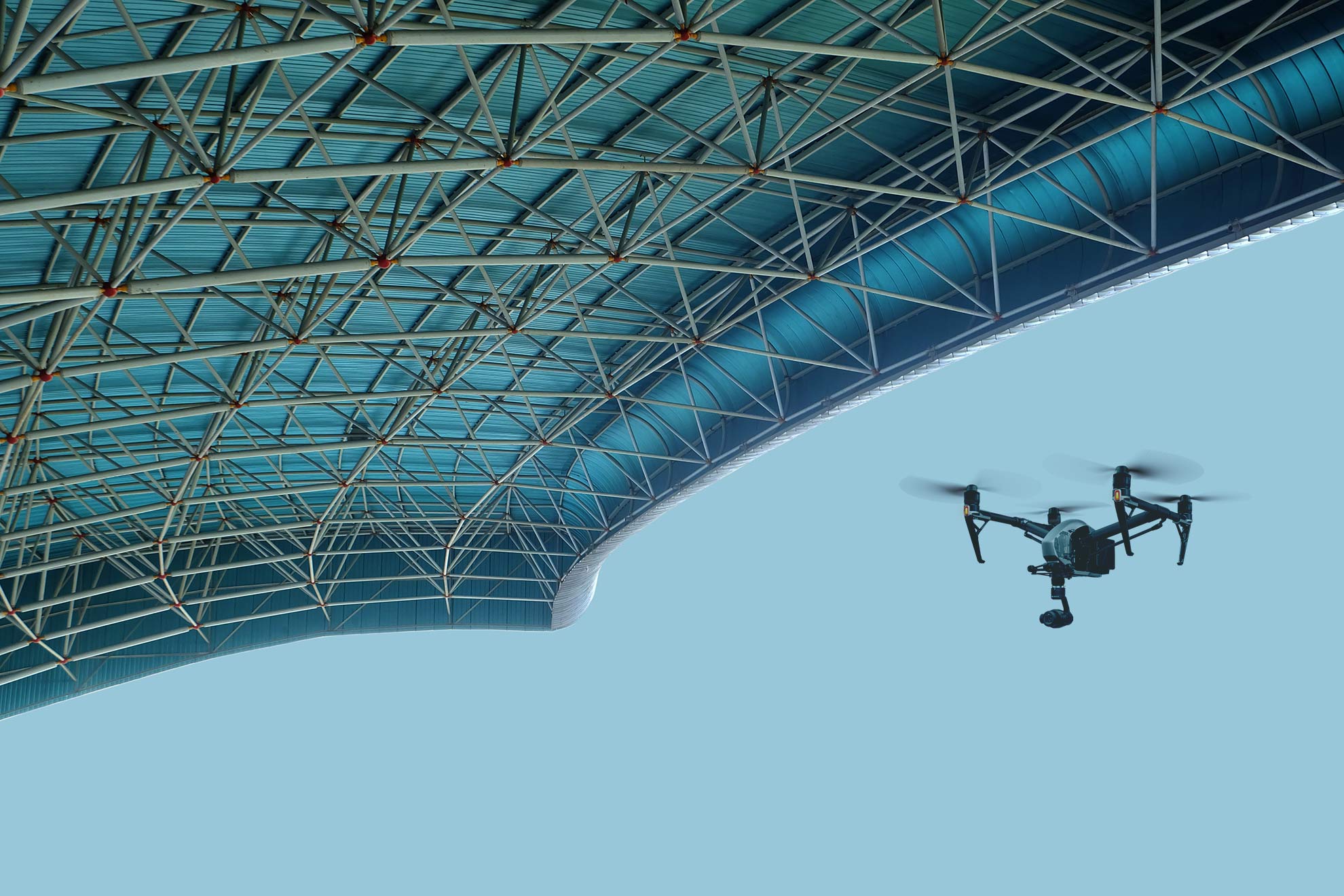
Aerial Analytics uses a number of high resolution cameras and multi-spectoral sensors on our drones. Using drones provides you with a cost efficient and safe way to improve your business operations
Drones are safe and cost effecitve way to capture unique insights for your business
High quality cameras allow us to produce topographical maps and 3D models for your sites
Dashboards for IOT sensors allow you to keep track real time of your weather and soil on you site
We are based in Sydney, NSW but travel Australia wide.
Aerial Analytics is committed to helping businesses improve their operations using cutting edge technology. We don't cut corners, the safety of our staff, our clients our equipment and our clients assets is paramount.
We are CASA Certified and hold all the necessary insurances.